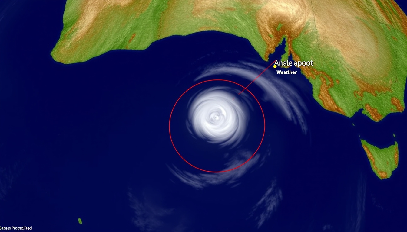
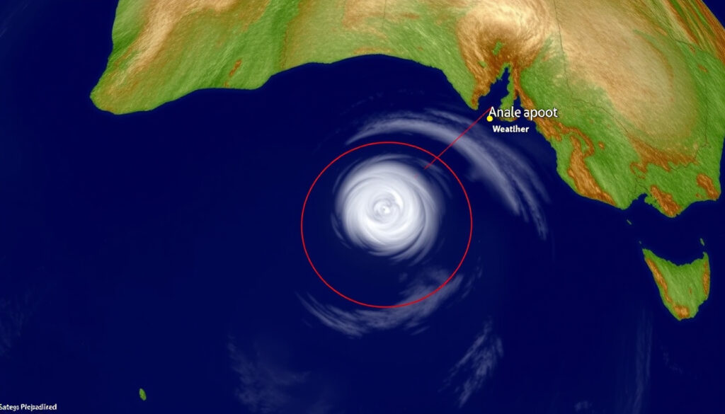
Tracking a tropical cyclone from your phone while watching the sky outside your window is a strange feeling — data meets reality in real time. With Cyclone Alfred now bearing down on southeast Queensland, knowing exactly where it is and how to prepare matters more than any forecast. This guide combines live tracking tools, official Bureau of Meteorology warnings, and practical safety steps so you can stay ahead of the storm.
Peak wind speed: 215 km/h (Category 4) ·
Active period: 22 February – 8 March 2025 ·
Regions under warning: Southeast Queensland, northeast New South Wales ·
Highest reported wind (ship): 83 km/h at 60 UTC 5 March ·
Fatalities: None reported
Quick snapshot
- Alfred reached Category 4 intensity with 215 km/h winds (Zoom Earth satellite tracker)
- BoM forecasts landfall over Queensland coast late 8 March 2025 (Australian Bureau of Meteorology)
- No fatalities reported as of 7 March 2025 (Zoom Earth satellite tracker)
- Exact landfall location and time remain uncertain
- Storm surge height depends on tide timing at landfall
- Whether Alfred will weaken before impact is unknown
- Formed 22 Feb 2025 northeast of Cooktown (Australian Bureau of Meteorology)
- Peak intensity 27–28 Feb (Category 4) (Australian Bureau of Meteorology)
- Expected landfall 8 March 2025 (Australian Bureau of Meteorology)
- Landfall expected along southeast Queensland coast (Get Ready Queensland)
- Brisbane and Gold Coast under warning (Get Ready Queensland)
- Evacuation orders in low-lying areas (Get Ready Queensland)
Key facts about Cyclone Alfred are summarised in the table below.
| Attribute | Value |
|---|---|
| Storm name | Severe Tropical Cyclone Alfred (22U) |
| Peak wind (10-min sustained) | 215 km/h (Category 4) |
| Last reported position (7 March 2025) | Approximately 500 km east of Brisbane |
| Direction | West-southwest toward the Queensland coast |
| Central pressure | Around 940 hPa (estimated) |
| Active period | 22 February – 8 March 2025 |
| Regions under warning | Southeast Queensland, northeast New South Wales |
| Highest recorded wind (Brisbane Airport) | 93 km/h at 11.16 pm 7 March 2025 |
The pattern: Alfred’s power and track data confirm this is a rare severe event directly threatening a major population centre.
Where is Tropical Cyclone Alfred going to hit?
Forecast path and timeline
The Australian Bureau of Meteorology (Australia’s national weather authority) forecasts Alfred making landfall over the Queensland coast late on 8 March 2025. The storm’s centre is expected to cross somewhere between Cape Moreton and Evans Head, with Brisbane, the Gold Coast, and the Sunshine Coast all within the warning zone.
Alfred’s path shifted over the past week. After forming as a tropical low northeast of Cooktown on 21 February, it intensified rapidly — reaching Category 4 on the Australian scale by 27–28 February. The system then recurved west-southwest toward the Queensland coast, transitioning to subtropical classification on 3 March before re-intensifying to Category 2 on 6 March 2025 (Australian Bureau of Meteorology).
The transition from subtropical back to tropical cyclone status on 5 March gave Alfred a second wind, complicating forecast models as it closed in on the coast.
— Bureau of Meteorology track history
Residents between Brisbane and the Gold Coast face the highest impact risk because forecast models consistently place the eastern side of the eye — the strongest section — over these populated areas.
Which cities are in the warning zone?
- Brisbane — Australia’s third-largest city, with 2.5 million residents in the metro area. Brisbane Airport recorded 93 km/h winds on 7 March.
- Gold Coast — Beaches and canals make this area especially vulnerable to storm surge. Evacuation orders were issued for low-lying suburbs.
- Sunshine Coast — North of Brisbane, expected to see heavy rain and destructive winds but potentially less storm surge.
- Northern NSW — Areas from Evans Head to Byron Bay are under warning, though the worst impacts are expected north of the border.
How to track Cyclone Alfred live: maps and satellite tools
Zoom Earth satellite imagery
Zoom Earth’s tropical storm tracker provides 10-minute satellite updates for Alfred, showing cloud-top temperatures, rainfall bands, and the storm’s eye structure. The platform combines Geostationary Meteorological Satellite imagery with high-resolution visible and infrared bands. For casual trackers, the animated overlay makes it easy to see Alfred’s rotation and direction without reading wind-speed tables.
Zoom Earth refreshes faster than most government portals, making it the go-to for anyone watching Alfred’s approach hour by hour from Brisbane or the Gold Coast.
Weather Underground tracker
Weather Underground (global weather data platform) shows a 5-day forecast track and ensemble computer model runs for Alfred. The site’s “Spaghetti Models” view lets you see where different forecast models agree — and where they diverge. For the 7 March forecast, the spread between the European (ECMWF) and American (GFS) models was roughly 80 kilometres for landfall location, which is significant for evacuation planning.
Windy hurricane tracker
Windy (visual weather mapping tool) overlays wind speed, wave height, and atmospheric pressure layers directly onto a global map. Switch to the “Wind” layer to see Alfred’s surface wind field — a broad area of gale-force winds extending hundreds of kilometres from the centre. For Queensland residents, the “Wave” layer shows modelled swell heights of 8–12 metres off the coast as of 7 March 2025.
BoM cyclone page
The Bureau of Meteorology (Australia’s official cyclone warning authority) publishes the definitive track map, cyclone watch and warning zones, and three-hourly technical bulletins. The BoM page also includes storm tide warnings for specific coastal locations — critical information that third-party trackers may not display. For official evacuation decisions, the BoM’s “Tropical Cyclone Advice” series is the authoritative source.
Google Maps cyclone layer (Australia)
Google Maps in Australia may display a live cyclone layer via the weather data toggle. Navigate to the layer menu (stacked diamond icon on mobile) and select “Weather” — if active, Alfred’s position and forecast track will overlay on the standard street map. This is especially useful for visualising which suburbs fall inside the forecast cone.
The pattern across all these tools: no single source is sufficient. The BoM provides legal authority, Zoom Earth gives speed, Weather Underground offers model diversity, and Windy adds visual clarity. Combine three for a fuller picture.
What areas will Cyclone Alfred impact?
Primary impact zone: Queensland coast
The Australian Bureau of Meteorology warns of destructive winds, heavy rainfall (200–400 mm in 48 hours), and dangerous storm surge along the southeast Queensland coast. The area from Cape Moreton to Evans Head is most at risk, with Brisbane and the Gold Coast in the direct path as of the latest forecast. Low-lying coastal suburbs — particularly those along Brisbane River, the Gold Coast canals, and Bribie Island — face the greatest surge threat.
Secondary impact: northern NSW
Northern New South Wales, while south of the likely landfall zone, will still experience heavy rain, flooding, and damaging winds as Alfred’s outer bands sweep south. The Bureau of Meteorology (national weather service) has issued flood watches for catchments from the Tweed to the Clarence rivers. Residents in low-lying areas of Byron Shire and Lismore should monitor BoM warnings closely, as these regions have experienced catastrophic flooding in previous storm events.
Worst-hit areas and storm surge risk
- Bribie Island — Alfred crossed here at 8 pm AEST on 8 March as a subtropical system, according to BoM records.
- Redcliffe — Recorded peak gusts of 104 km/h on 8 March, indicating the area took the brunt of the storm’s wind field.
- Brisbane River mouth — Storm surge could push water upriver, threatening riverfront properties.
- Gold Coast canals — Narrow waterways amplify surge effects; evacuation orders were issued for canal-front suburbs.
The trade-off: coastal residents face both wind and water threats, while inland areas mainly deal with rainfall flooding. If you’re on the coast, the storm surge risk is the bigger danger — not the wind.
What is the difference between a cyclone and a hurricane?
Same storm type, different names by basin
According to the US National Hurricane Center (NOAA’s tropical cyclone division), the terms “cyclone”, “hurricane”, and “typhoon” all refer to the same meteorological phenomenon: a tropical cyclone with sustained winds of at least 119 km/h. The name changes based on the ocean basin where the storm forms. In the Atlantic and eastern Pacific, they’re called hurricanes. In the northwest Pacific, typhoons. In the Indian Ocean and South Pacific — including Australia — they’re called cyclones.
The only difference between a cyclone and a hurricane is the longitude where it happens — the physics is identical.
— NOAA National Hurricane Center glossary
Saffir-Simpson scale and Australian categories
Australia uses a Category 1–5 system based on 10-minute sustained wind speeds, while the US Saffir-Simpson scale uses 1-minute sustained winds. This means an Australian Category 4 (215 km/h 10-minute wind) would rate higher on the US scale — approximately Category 5 equivalent in 1-minute averages. The Bureau of Meteorology (Australia’s weather authority) clarifies: “Australian categories are based on the maximum mean wind speed over a 10-minute period.”
Why naming conventions differ
Historical regional naming conventions, not meteorological differences, explain the three labels. The World Meteorological Organization (WMO) maintains regional lists for each basin. Cyclone Alfred, named by the Australian Bureau of Meteorology, would have been called Hurricane Alfred if it had formed in the Atlantic. For Queensland residents, the practical takeaway: don’t be confused by the different words — prepare the same way.
The catch: when you hear that Alfred is a Category 4 cyclone, its destructive potential is comparable to a Category 5 Atlantic hurricane. Treat it with that level of caution.
Should you open windows in a cyclone?
Official advice: do not open windows
Get Ready Queensland (Queensland Government disaster preparedness authority) is clear: DO NOT open windows during a cyclone. Opening windows allows wind and debris to enter your home, increasing the risk of injury and internal damage. The pressure difference myth — that opening windows “equalises” pressure and prevents roof lift — has been debunked by structural engineers. Modern buildings are designed to vent pressure differentials through their building envelope, not through open windows.
Why the myth persists
The myth dates back to older construction methods and may have had some validity for poorly sealed structures. For modern homes, the advice has reversed. The Bureau of Meteorology states: “Close all windows and doors. Stay in the strongest part of the house.” Opening windows creates flying debris hazards and compromises the building’s structural integrity.
The catch: if you’ve already secured your home according to Queensland guidelines, the windows are the last thing to worry about — your shelter room is where you should focus your energy.
Where is the safest place in your house during a cyclone?
Interior room away from windows
Get Ready Queensland recommends sheltering in a small interior room — a bathroom, hallway, or walk-in wardrobe — on the lowest floor of your home. The key is to be as far from windows and external doors as possible. Interior bathrooms are particularly safe because plumbing in the walls provides additional structural reinforcement. Avoid rooms with large glass panels, skylights, or exterior walls.
Bathroom or hallway on lowest floor
If your home has a basement, that’s the safest location. Most Queensland homes are built on slabs, so choose an interior room with no windows. Stay away from doors that lead outside. Get under a sturdy table or mattress for protection from debris if the structure fails. Keep your emergency kit close.
If you live in a high-risk zone: evacuate to a public shelter
If you live in a manufactured or mobile home, a high-rise apartment above the third floor, or a low-lying coastal area under evacuation order, do not stay at home. Evacuate to a designated cyclone shelter or sturdy public building. The Queensland Government emergency management portal lists open shelters by region. Evacuation routes are signposted; plan your route before the storm arrives.
The implication: for most people in a standard brick or timber home, the bathroom floor is the safest square metre in the house. If you’re in a high-risk zone, no room in your house is safe — leave early.
What is the 30 minute thunder rule?
The 30/30 rule explained
The US National Weather Service (NOAA’s weather safety division) established the 30/30 lightning safety rule: if the time between a lightning flash and the thunderclap is 30 seconds or less, the lightning is close enough to be dangerous — seek shelter immediately. This rule applies during cyclones because storm bands produce frequent lightning, even outside the eyewall. For each 5-second interval, the lightning is roughly 1.6 kilometres away.
When to seek shelter and when to leave
Once inside, wait at least 30 minutes after the last thunderclap before leaving shelter. Many lightning casualties occur after the storm passes but before the danger is over. In the context of Cyclone Alfred, applying the 30/30 rule means staying in your interior shelter room even after the wind dies down during the eye of the storm — lightning can still pose a risk. Only leave your shelter when both the storm and the lightning threat have clearly passed.
During Alfred’s landfall, the lightning threat may be higher than typical for tropical cyclones because the storm’s subtropical transition increased convective activity, according to BoM analysis.
Cyclone Alfred timeline
Key events in Cyclone Alfred’s lifecycle are laid out below.
| Date/Period | Event | Source |
|---|---|---|
| 21 February 2025 | Tropical low 22U forms northeast of Cooktown | Australian Bureau of Meteorology |
| 23 February 2025 | Named Alfred at 10 am AEST, 320 km northeast of Willis Island | Australian Bureau of Meteorology |
| 27–28 February 2025 | Rapid intensification to Category 4, peak winds 215 km/h | Zoom Earth |
| 3 March 2025 | Transitioned to subtropical classification | Australian Bureau of Meteorology |
| 5 March 2025 | Re-classified as tropical cyclone Category 1 | Australian Bureau of Meteorology |
| 6 March 2025 | Intensified to Category 2 at 4 am AEST | Australian Bureau of Meteorology |
| 8 March 2025 | Crossed Bribie Island (8 pm AEST), moved onto mainland (9 pm AEST) | Australian Bureau of Meteorology |
The pattern: Alfred’s second life as a Category 2 cyclone after its subtropical phase means it hit the coast with more organised energy than if it had stayed subtropical — making the landfall impacts worse than initial forecasts suggested.
Related reading: Disaster Relief Payment · Power Outage Sydney
For real-time updates on the storm’s path and intensity, refer to the Cyclone Alfred tracker live map provided by the Bureau of Meteorology.
Frequently asked questions
What is a tropical cyclone?
A tropical cyclone is a rapidly rotating storm system characterised by a low-pressure centre, strong winds, and heavy rain. It forms over warm tropical oceans. The Bureau of Meteorology (Australia’s weather authority) defines it as a “non-frontal, synoptic-scale cyclone” with organised thunderstorm activity.
How often does a Category 4 cyclone hit Queensland?
Category 4 or higher cyclones make landfall in Queensland roughly once every 5–10 years. Notable recent examples include Cyclone Yasi (2011) and Cyclone Marcia (2015). Alfred’s threat to Brisbane is particularly rare — Category 4 storms typically hit less populated parts of the north Queensland coast.
When should I evacuate for a cyclone?
Evacuate immediately if an evacuation order is issued by the Queensland Government emergency management. If you live in a low-lying coastal area, a manufactured home, or a high-rise above the third floor, leave early. Do not wait until the storm arrives — roads may be flooded or blocked by debris.
How do I protect my home before a cyclone?
Secure outdoor furniture and loose items that could become projectiles. Board up windows if possible. Trim trees near the house. Fill your car’s fuel tank and park it under cover where possible. Prepare an emergency kit with water, food, medications, torches, and batteries. Full guidance is available from Get Ready Queensland.
Is Cyclone Alfred dangerous now?
Yes. Even if Alfred weakens before landfall, it remains a dangerous system with destructive winds, heavy rain, and storm surge. As of 7 March 2025, the Bureau of Meteorology has issued cyclone warnings for the southeast Queensland coast. Treat all warnings seriously.
What supplies should I have for a cyclone emergency?
At minimum: at least 3 litres of water per person per day (for 5 days), non-perishable food for 5 days, a first-aid kit, torches with extra batteries, a battery-powered radio, medications, and important documents in a waterproof bag. Get Ready Queensland has a complete emergency kit checklist.
Where can I find official evacuation routes?
Evacuation routes are published by the Queensland Government emergency management portal. Local council websites also provide suburb-level evacuation maps. During an active event, the BoM’s cyclone warnings include links to evacuation information for affected areas.

Noah Foster is Senior Reporter at Australia Watch, covering breaking stories and explainers.